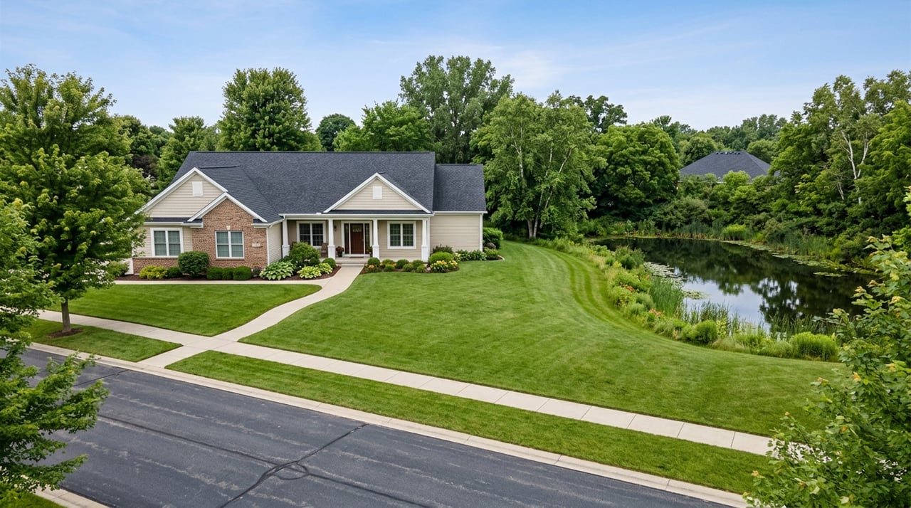
In Murrells Inlet, Two Homes at the Same Price Can Have Two Different Insurance Realities
September 17, 2026
September 17, 2026
Pull up two Murrells Inlet listings priced within a few thousand dollars of each other and the comparison sheet looks almost identical. Similar square footage, similar age, similar bedroom count. One sits a short golf cart ride from TPC Myrtle Beach. The other sits within walking distance of the MarshWalk, close enough to smell the marsh at low tide. On paper, the only real difference is a five-character code buried near the bottom of the listing sheet: the FEMA flood zone. That code, more than the view or the lot size, decides whether the number on the sign is the whole cost of the house or just the opening bid.
For the three months ending in June 2026, Murrells Inlet's median sold price landed around $495,000, up roughly 7 percent from the same period a year earlier, and homes were moving faster too, spending around 90 days on market compared with about 107 the year before. Those are the numbers most buyers see first, and they're accurate as far as they go. What they don't show is that this median blends two very different towns sitting under one zip code, and the line between them isn't the water. It's the flood map.
Homes along the creeks and marsh in Murrells Inlet, including much of the stretch near the MarshWalk and South Waccamaw Drive, are commonly mapped in FEMA Zone AE. That designation means the property has a documented risk of flooding in a base storm event, and it triggers a specific chain of requirements. Lenders require flood insurance for any federally backed mortgage on a Zone AE property. An elevation certificate, prepared by a licensed surveyor, becomes essential to pricing that insurance accurately, since two houses a hundred feet apart can carry very different premiums depending on how many feet their lowest floor sits above the base flood elevation.
The premiums themselves have moved sharply in the last few years. Under FEMA's Risk Rating 2.0 system, Georgetown County flood policies that once averaged closer to $969 a year have pushed past $1,400 for many homeowners, with some seeing increases north of 100 percent. Depending on elevation and building type, annual Zone AE premiums along the Grand Strand commonly run from roughly $1,500 up to $5,000 or more. That's before homeowners insurance, before wind coverage, before anything else on the closing disclosure.
Head inland a few miles and the map changes. Prince Creek, the roughly 2,800-acre master-planned community built around TPC Myrtle Beach, sits about four miles from the Atlantic. TPC Myrtle Beach itself is a Tom Fazio design and home to the Dustin Johnson Golf School, and the neighborhoods that ring it, Highwood, Collins Creek Landing, and the gated 55-plus enclave Seasons at Prince Creek West among them, are described in flood terms as low risk enough that many are marketed as sitting outside a mapped flood zone altogether.
That single classification, Zone X instead of Zone AE, changes the entire cost structure of owning there. Flood coverage in Zone X is optional rather than lender-mandated, and a preferred-risk policy typically runs $400 to $800 a year rather than the $1,500 to $5,000-plus a Zone AE property can carry.
A house is not a spreadsheet, but the spreadsheet still runs underneath it. The same $470,000 can buy a home where flood coverage is a rounding error or a home where it's a second mortgage payment.
| Marsh and creek-front (typically Zone AE) | Prince Creek golf communities (typically Zone X) | |
|---|---|---|
| Flood insurance for a financed purchase | Required by lender | Optional |
| Elevation certificate | Effectively necessary for accurate pricing | Rarely required |
| Typical annual flood premium | Roughly $1,500 to $5,000+ | Roughly $400 to $800 |
| HOA cost pattern | Varies, often lower or none | Predictable, often bundled with amenities (Seasons at Prince Creek West runs roughly $300 to $330 a month covering the indoor pool, clubhouse, and landscaping) |
| Distance to MarshWalk / TPC Myrtle Beach | Walking or short drive to MarshWalk | Golf cart distance to TPC Myrtle Beach |
Murrells Inlet is not a single municipal jurisdiction. It straddles the Horry and Georgetown county line, and that matters here in a way it doesn't for most buyer decisions. Each county maintains its own FEMA flood maps and can carry a different Community Rating System standing, the program that gives residents of participating communities a discount of 5 to 45 percent on NFIP premiums based on local floodplain management practices. Two homes a few streets apart, on the same creek, can end up governed by different flood maps and different discount schedules depending on which side of that county line the parcel falls. Horry County keeps its flood insurance rate maps posted for public review, and it's worth a look before assuming your side of the inlet works the same way as your neighbor's.
None of this means golf course living is risk-free. FEMA data shows that close to 20 percent of all flood insurance claims nationally come from properties outside the officially mapped high-risk zones, meaning Zone X homes flood too, just less often and less severely on average. A cheap preferred-risk policy on a Prince Creek home is inexpensive enough that skipping it to save $500 or $600 a year is a bet most buyers don't need to make. The zone determines whether insurance is required and how much it costs, not whether water is physically possible.
Flood zone aside, coastal Georgetown County homeowners have watched general insurance premiums climb 20 to 35 percent since 2023. A policy covering $250,000 in dwelling value now averages around $1,500 a year, about 20 percent above the national average. Hurricane wind deductibles compound this. Most coastal South Carolina policies carry a deductible of 2 to 5 percent of the insured value rather than a flat dollar figure, so a $500,000 home with a 2 percent deductible means $10,000 out of pocket before wind coverage pays a dime. That math applies whether the house sits on the marsh or the fairway.
Does every home near the Murrells Inlet MarshWalk require flood insurance? Not automatically, but most creek and marsh-adjacent parcels in that area are mapped Zone AE, which does require flood coverage for any federally backed mortgage. The elevation certificate for that specific lot determines the actual premium.
Is Prince Creek completely free of flood risk because it's Zone X? No. Zone X means low probability, not zero probability. Nationally, a meaningful share of flood claims come from outside mapped high-risk zones, which is why an inexpensive preferred-risk policy is worth carrying even where it isn't required.
Can I buy flood insurance the week before closing and be covered? No. Standard NFIP policies carry a 30-day waiting period before coverage begins, so the quote and application need to happen well before closing day, not at the closing table.
Does the flood zone split affect resale, not just my monthly costs? It affects who your eventual buyer pool looks like. A future buyer financing through a federally backed mortgage on a Zone AE property inherits the same insurance requirement you did, which is part of why elevation and flood history tend to matter more to appraisers and lenders here than in many inland markets.
Comparing Murrells Inlet neighborhoods on price alone tells you less than it feels like it does. The real comparison happens on the flood map, the county line, and the elevation certificate, three documents most buyers never ask to see until they're already under contract. If you're weighing a marsh cottage against a golf course home here, or trying to figure out what a given listing actually costs once insurance is factored in, Life in Myrtle Beach can walk you through the specific parcel, not just the neighborhood average. Start Your Life at the Beach with the numbers in front of you before you write the offer, not after.
Stay up to date on the latest real estate trends.

Whether you’re buying your first home, selling a property, or exploring Myrtle Beach living, we’re here to make the process seamless. With local expertise and a people-first approach, we’ll guide you every step of the way.